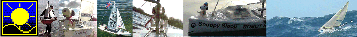


Home .
About .
GPS .
Downloads .
Business .
Partners .
Contact .
Family .
AVL .
Links .
History .
AsOnTV .
Forum
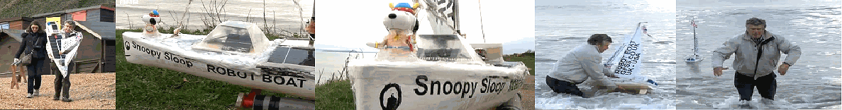 Play the
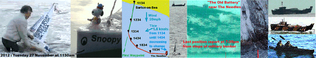
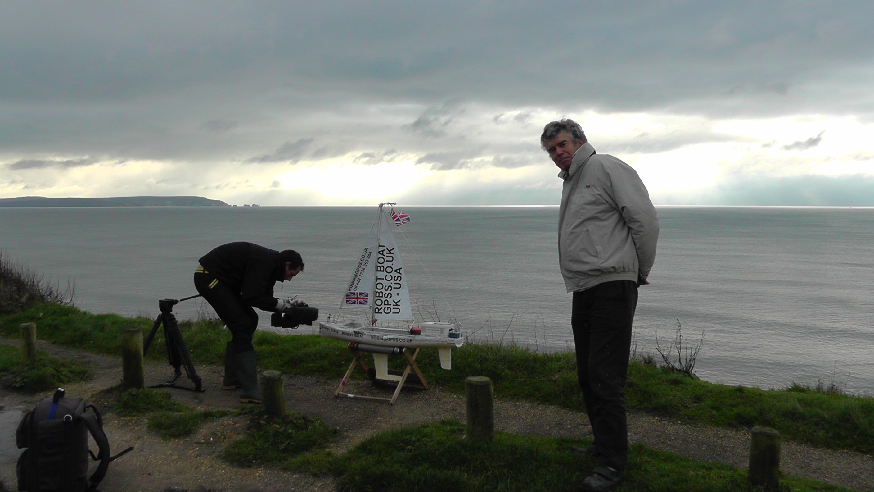
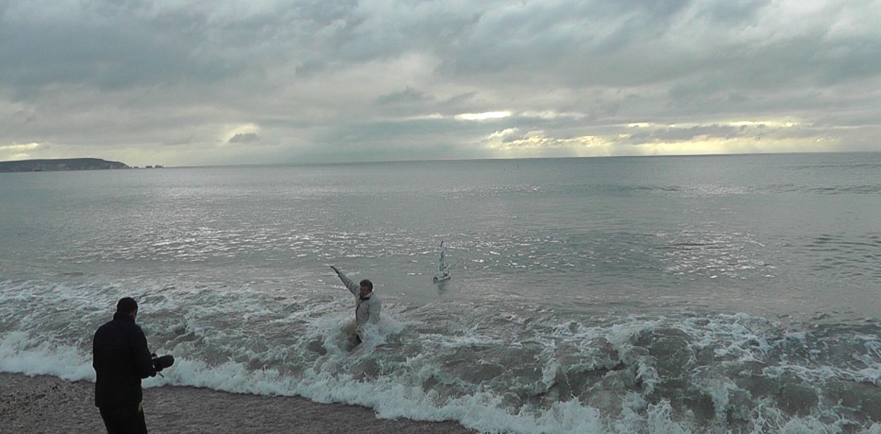
November 2012 video of Snoopy's launch on BBC TV South News
with Robin getting soaked.
Then
family video of Snoopy's 2012 launch
.
The
Old BBC Page is here
.
Play the
November 2012 video of Snoopy's launch on BBC TV South News
with Robin getting soaked.
Then
family video of Snoopy's 2012 launch
.
The
Old BBC Page is here
.
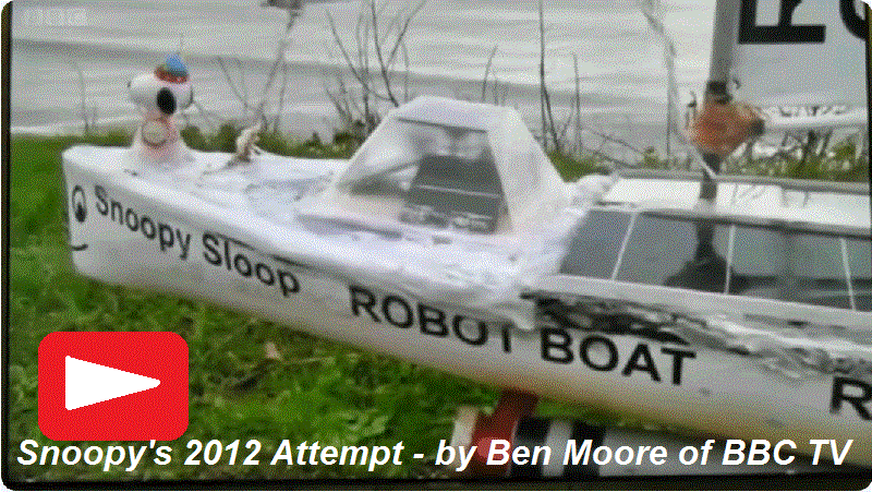
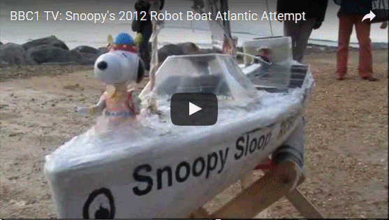
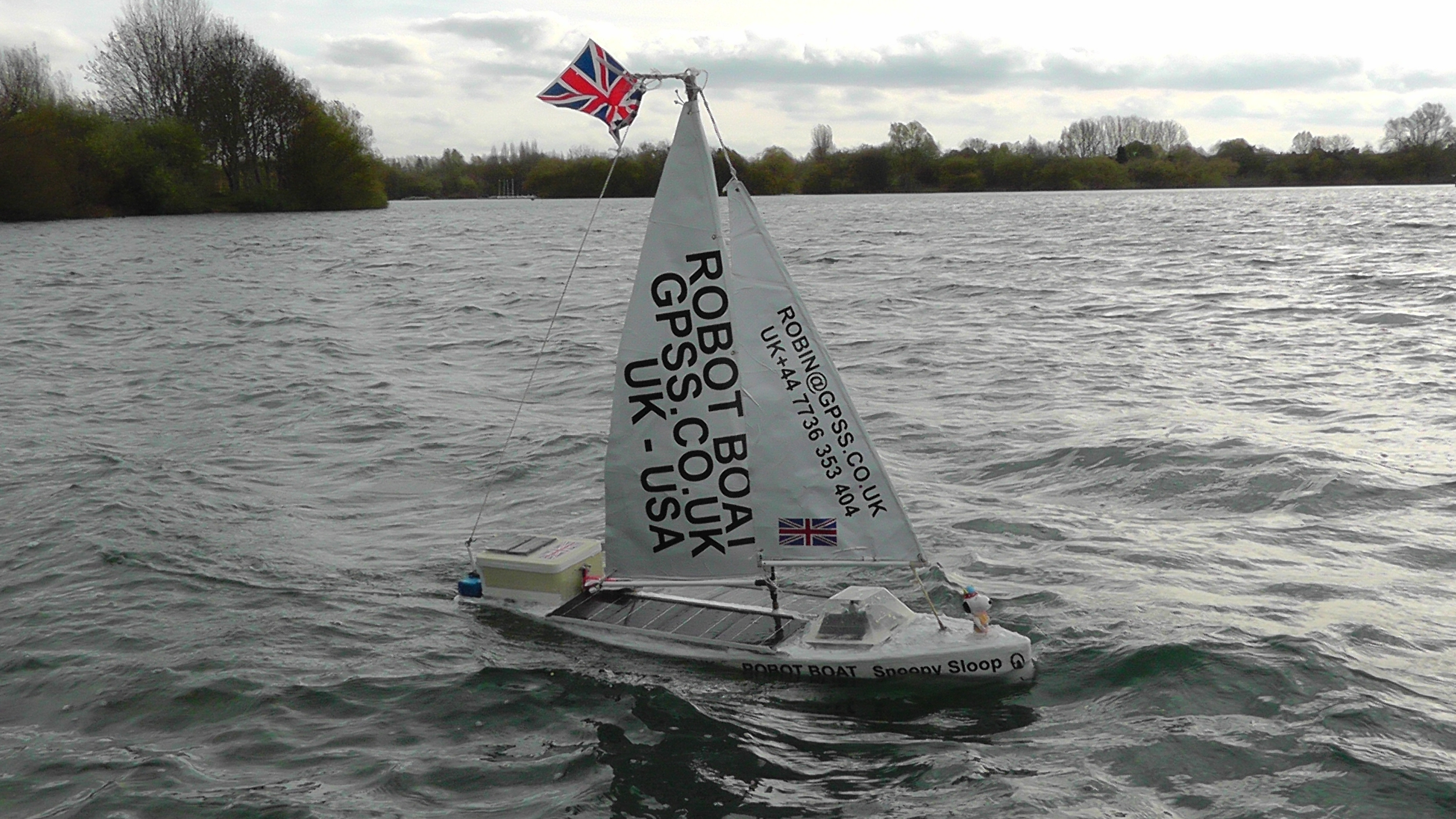
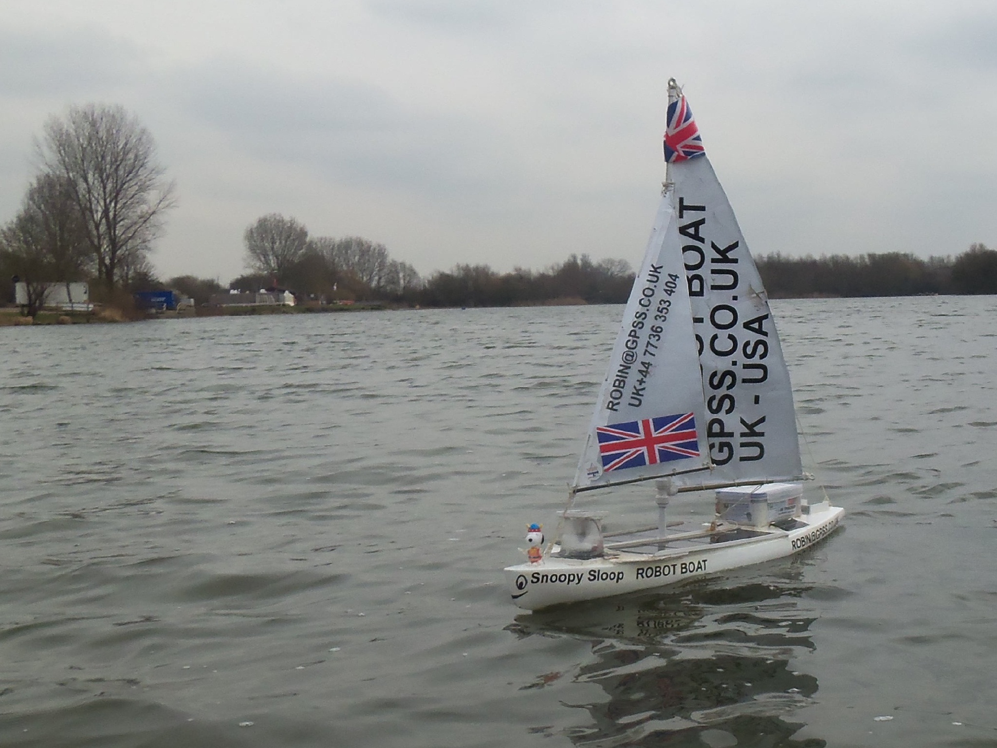
Snoopy's 2012 Attempt to cross The Atlantic
updated Monday 21st October 2013 UK time - translation flags and videos below added 11th September 2024

If you stumbled on this page by accident, and need "the bigger picture", see
Snoopy's GPS Guided Trans-Atlantic Robot Boat which usually holds the latest news.
This page describes Snoopy's first attempt to cross the Atlantic, from UK to USA. That was in November 2012.
The material was on the front page, but that is getting full with later attempts ! :-)
We learn something on each attempt. e.g. in 2012 we saw that Snoopy can sail straight, despite a strong tide - but we need to keep an eye on him :-)
Possible sighting of lost Snoopy Sloop 8 ? See "Where did Snoopy go ?" below.
Snoopy's first attempt, in November 2012 .... what happened ?
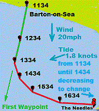
In brief: Snoopy sailed straight towards his destination, despite a strong sideways tide. Then he moved AGAINST the tide !
He then landed on the steps of an old military bunker !
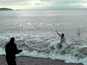
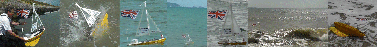
Sailed at 1130am on Tuesday 27th November ...
taken by
someone
at 1:45pm to near
The Needles ...
released after 5:30pm to
sail onto the rocks ...
reported his GPS position for another hour ...
... then Snoopy went AWOL ! :-)
Help us discover what happened to Snoopy ...
Where did Snoopy go ?
 Whoever snatched Snoopy, in November 2012, released him again in Alum Bay. The question is then "where did Snoopy go next ?"
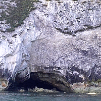
Robin's best guess: hidden in the corner of Alum Bay, in or near a cave, or further east along that north coast
of the Isle of Wight ?
70% chance ??? above still true for Snoopy's first two weeks on Isle of Wight while winds were from north ?
But the wind changed !
20% chance ??? that new wind has blown Snoopy onto UK mainland: Barton-on-Sea to Hurst Castle, or even to Lee-on-the-Solent ?
10% chance ??? that "wind bending" caused by cliffs, changed north wind to an east wind, and blew Snoopy past Needles ?
to the French coast ?
0.1% chance ??? that Snoopy got past Needles, with undamaged rudder and autopilot, and is on his way to annoy the Americans in 2013 ? :-)
Is that Snoopy's boat, on it's side, to the right of a cave ? Click on the picture or
here
to see the search page, and the picture taken in July 2013.
Searching for Snoopy ...
See
The Search for Snoopy in his Robot Boat - for more information to those helping,
such as the map showing coverage of searches done since Snoopy hit the rocks.
Who caught Snoopy
and carried him into Alum Bay ? :-)
An important message to the sailor who "snatched" Snoopy
:
Don't worry - you must know from these pages, that I do have a sense of humour ! :-)
Robin's open letter to "Mr Snoopy-Snatcher" is
here :-)
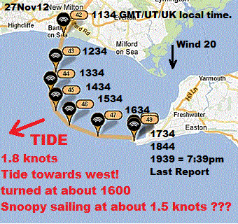 Robin noticed, rather late, that his tidal current data did not match up with the movement of Snoopy.
Why is this so important ? There were two reasons:
1. the next launch of Snoopy should be at a time when "the tide is right". It WAS right on the 27th !
2. if Robin's data was correct, then Snoopy was "stolen" by a passing boat that Tuesday afternoon ! :-)
Even if Snoopy is now lost, it would be good to know for sure, what happened.
Unexplained things might delay Snoopy's next boat being dropped into the sea again soon.
Robin is very grateful to Chris at the UKHO, who sent him detailed tidal current data by email.
The result was so dramatic that Robin had to 'phone Chris back immediately, to make sure he'd not misunderstood it.
THE TIDE WAS FLOWING TOWARDS THE WEST when Snoopy appeared to be dragged to the east, onto the Needles.
There are many good implications for this latest information. e.g. that
Snoopy was not "confused" by the tide.
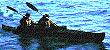
The GPS track shows that, after being "caught", Snoopy was carried at about 1.5 knots into Alum Bay.
What sails at 1.5 knots ? A sea kayak with Snoopy ? :-) It would only have taken 30 minutes
from Alum Bay or Freshwater, with the tide, to reach Snoopy - but bringing him back must have been something else !
If you know who it was, please show them this page.
Whatever they did, will not be a problem for them - in fact quite the reverse ! :-)
an alternative explanation to Snoopy having been "snatched" ? :-)
Snoopy appears to have been "snatched" at about 1:45pm Tuesday afternoon.
This was after over two hours sailing in a perfectly straight line, direction 190 degrees.
This is shown clearly on
Snoopy's
Track on Google Earth. This was about 3.1 miles / 2.6 NM / 4.9km from the shore,
if a few minutes after his 13:34 GPS position report.
Please tell me of any other explanation you can think of - but please look at the evidence here first.
Here are some suggestions:
- That the UKHO (
UK Hydrographic Office
) tidal data is wrong. i.e. tide was flowing to the east ?
Hardly likely - I've tested it against our GPS Bottle tests in 2011. The UKHO would have very red faces :-)
- That Snoopy had "weather helm" (turning him towards wind). e.g. if his jib broke and he became "unbalanced".
Hardly likely - the few hours in wind of 20mph was far less than the many weeks of 24/7 tests in winds of up to 50mph.
- "Wind Bending" caused by waves ? The North wind bent 90 degrees towards east, along bottom of wave trough ?
Sounds plausible - but does anyone know of an article that confirms and quantifies this effect - if it exists ?
But please keep the ideas coming :-)
recognition of shipping using photographs and AIS data...
 Suppose you have a photo: maybe taken near the beach that Tuesday afternoon, and in the background there is the sea, with perhaps
a blurred speck that might be a kayak or small sailing dingy - skippered by "
Mr Snoopy-Snatcher
" .... we might be able to match that speck with where Snoopy was at that time, from Snoopy's known GPS track. We will also need the
time of the photo (e.g. from the file name or PC properties of the digital picture), and where the camera was (e.g. by looking on
google maps
and doing a right click, then "What's Here?" to get the lat/lon. e.g. 50.7344,-1.6577.
Suppose you have a photo: maybe taken near the beach that Tuesday afternoon, and in the background there is the sea, with perhaps
a blurred speck that might be a kayak or small sailing dingy - skippered by "
Mr Snoopy-Snatcher
" .... we might be able to match that speck with where Snoopy was at that time, from Snoopy's known GPS track. We will also need the
time of the photo (e.g. from the file name or PC properties of the digital picture), and where the camera was (e.g. by looking on
google maps
and doing a right click, then "What's Here?" to get the lat/lon. e.g. 50.7344,-1.6577.
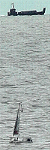
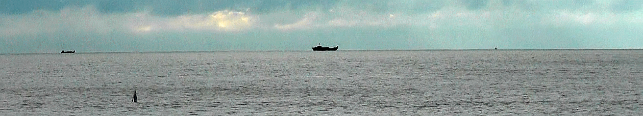
This picture below, taken at 1142, is obviously not directly relevant to photos that may show the boat that "caught" Snoopy at about 1:45pm that Tuesday afternoon.
Here, Snoopy was only about 300 yards from the shore, having only been launched 12 minutes earlier. Maybe ships, like those on the horizon,
can be used as mobile "landmarks", to get direction information on your photo, in a similar way to static landmarks like The Needles ?
 Here is an
AIS map
which shows you what is available.
Historical AIS
(
Automatic Identification System
)
might help us.
If you look at this
wider AIS map
you can see ships such as
ABIS Belfast
, 27 miles out. This ship is 89m long.
But how much would we have seen above the horizon at 27 miles ? Maybe not ! :-)
Here is an
AIS map
which shows you what is available.
Historical AIS
(
Automatic Identification System
)
might help us.
If you look at this
wider AIS map
you can see ships such as
ABIS Belfast
, 27 miles out. This ship is 89m long.
But how much would we have seen above the horizon at 27 miles ? Maybe not ! :-)
 Can you do better than Robin with these links ? Right now he's not managed to find ships that
match this picture in apparent size according to their distance away.
Can you do better than Robin with these links ? Right now he's not managed to find ships that
match this picture in apparent size according to their distance away.
If we can, then maybe AIS data can be used to help calibrate any photos that come in which may show Snoopy being carried to Alum Bay by kayak :-)
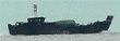
But maybe the
shape
of the ship is more useful.
Suppose that ship in the middle was a
Royal Marine LCU with the AIS off ?
For those into arithmetic: there are quite a few calculations that can easily be done from that picture.
e.g. Snoopy's sail is roughly 3 metres below the horizon - which matches where we stood with our camcorder on the beach.
On the cliff, it would have been very different. Those apparent sizes of ships on the horizon should match each
other and Snoopy's sail. e.g. if that ship in the middle was a
RM LCU
of length 30m, then it would appear about that size
if it were about 3 miles out,
where Snoopy was snatched: a good time and place to drop off a kayak ?
Pity that the return trip is such a long paddle ;-)
What the Papers say ... Don't believe all you read in the papers :-)
Read
Jasper Coppings article in the Sunday Telegraph the Sunday before launch.
Read BBC News report of "crash landing"
here
or
Nice pictures and amusing words in
The Mail Online here :-)
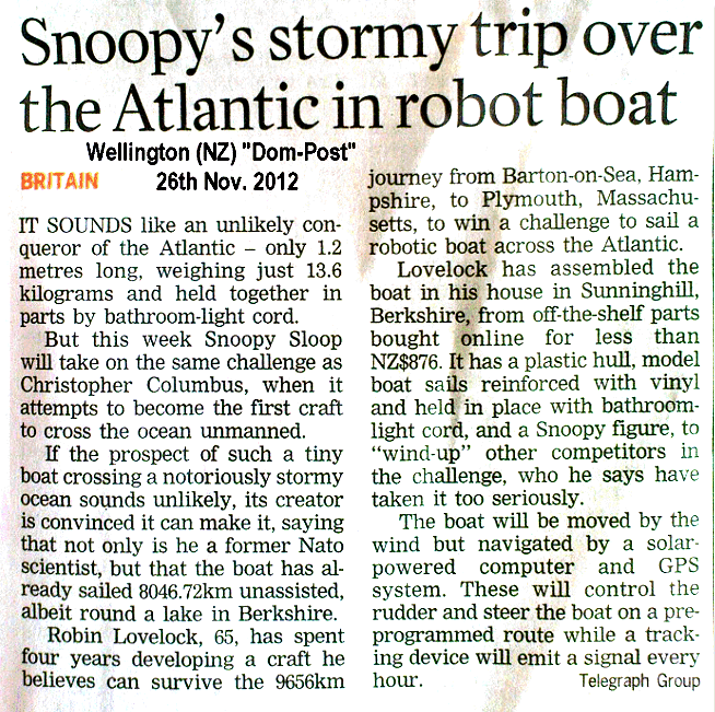
The news about Snoopy even got as far as New Zealand, in the Wellington,NZ
Dom-Post article :-)
First paper:
Snoopy prepared for self-navigating Atlantic voyage by Paul Miles in Maidenhead Advertiser on 5th September 2012.
Journalists may have started with our
Press Release and
video,
but editors need to edit : the meaning may not remain the same :-)
Robin says to
Tim Robinson of BBC Radio Solent
, "This is the guy who lost one of my GPS bottles last year !" :-)
Higher resolution pictures for the Press ...
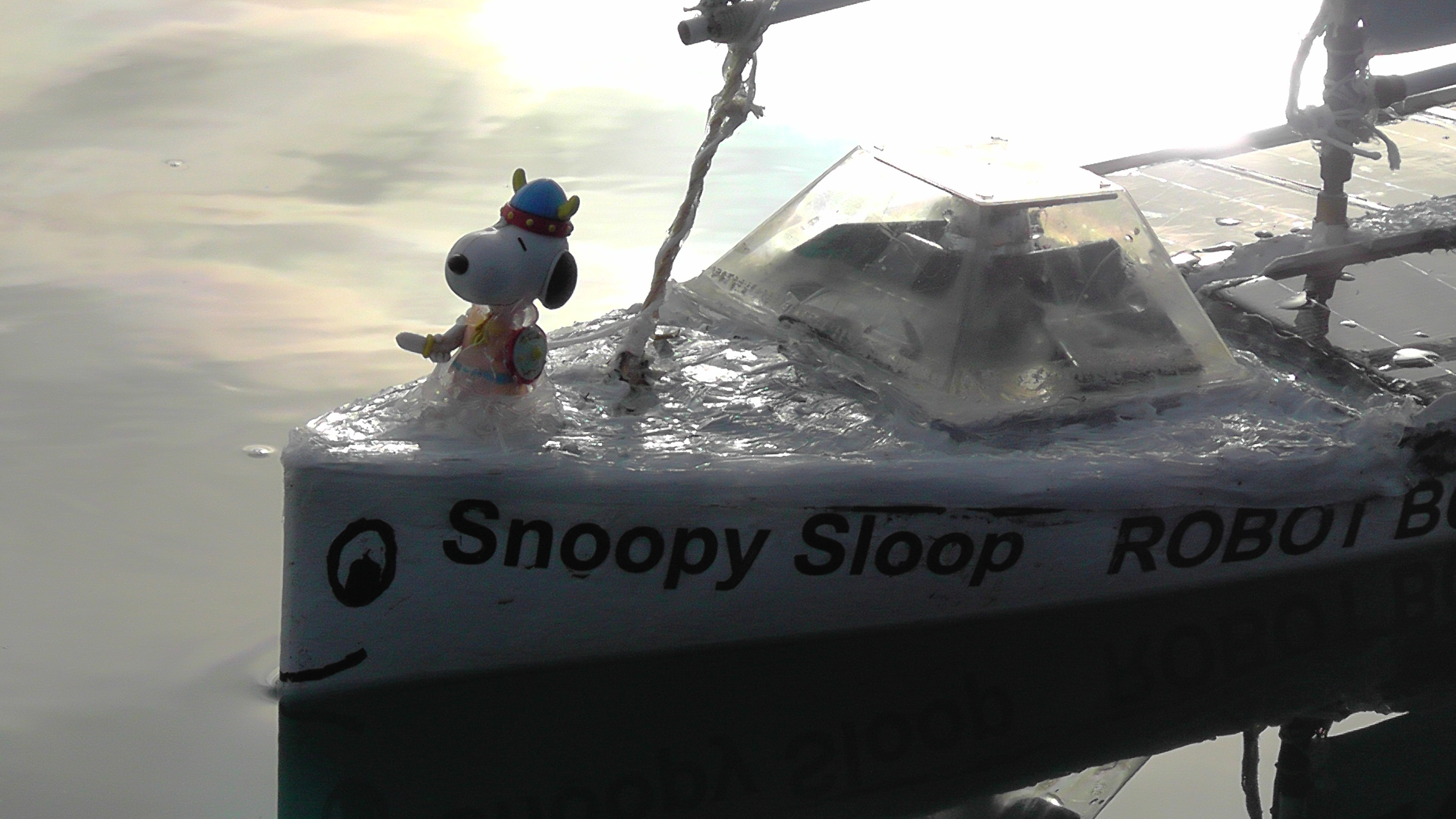
Snoopy,
Mug,
Boat,
Robin,
BenTV,
Launch,
TimRobin,
Cat,
NewBoat
Robin thanks his friends ...
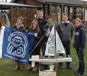
- All staff at
Bray Lake Watersports
for use of the lake, numerous rescue missions and coffees. Here they say bye-bye to Snoopy.
- local friend John who started Robin off, provided the team name, and has supplied numerous original ideas.
See Team-Joker.
- local friend Dick Bailey, who has been with Robin on numerous "adventures" and who rescued Snoopy in October 2013.
- Peter Facey for his own time and expense,
searching for Snoopy and those pictures
to help others.
www.geograph.org.uk
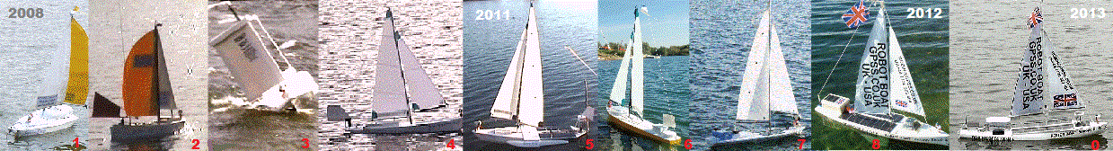
- local friend Eric, for supply of Snoopy Sloop 4, and our best videos.
See Eric's other videos
here.
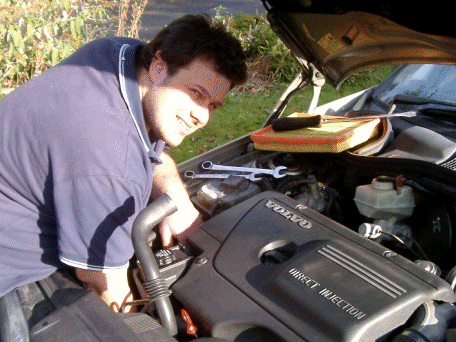
- local friend
Gary, the Master Car Mechanic
, for donating Snoopy Sloops 1 and 2, when Robin started all this in 2008.
- my old friend Klaus in Germany, who in 2008, suggested use of SPOT to me and Microtransat Teams.
Also for his interfacing card.
- the Intelligent Robotics Group at Aberystwyth University, Wales, for organising
Microtransat and their own heroic attempts.
- the French Teams for first suggesting The Microtransat Challenge years ago,
and their repeated heroic attempts. See below!
- Those in the Press who've gone "beyond the call of duty" including for last year's
BBC GPS Bottles project.
- The nice chap at the National Trust who called back with information about the military bunker where Snoopy landed.
- The nice lady who is Custodian of the
Needles Battery
. She has tweeted this, after checking with Robin:
"Can you help Robin find Robot boat Snoopy? See www.gpss.co.uk/rbaa12.htm if you can help. Last seen near The Needles."
Robin, despite his name, cannot Tweet. Please take care what you tweet, so as not to encourage others to take risks.
- Chris at the UKHO UKHO (
UK Hydrographic Office
) for detailed tidal data, confirming that Snoopy was "snatched" :-)
- My long-suffering wife, June, and all those that I've yet to thank here :-)
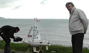
Snoopy's preparation for the Atlantic crossing - the first taste of salt water ! ...
relevant links ...
See Snoopy's Front Page to put this page into context. e.g. latest news on this year's attempt.
Also many more videos and links.
See Robin's Snoopy Sloop robot boat - progress in 2011 and 2012
for an earlier copy of material, now on this page, which was on the
front page. You may find more detail and links.
See
Snoopy's Track on Google Earth to analyse what happened on 27th November 2012.
See
Snoopy's last position on Google Maps
: 7:39pm Tuesday 27th, near a
military bunker
in Alum Bay.
See
The Search for Snoopy in his Robot Boat for more information
such as the map showing coverage of searches done in 2012.
See
The 2012 Microtransat Map
for Snoopy and the French.
This
SPOT Track
is from the
Mail Online.
This Map
before deletion.
See
www.marinetraffic.com
for how busy the shipping lanes are.
See
UK Winds
,
Sailflow Winds
,
Met Office Rain & Wind,
World
Sea conditions
,
Temperatures
and
Sunshine.
See
Jasper Coppings article in the Sunday Telegraph the Sunday before launch,
and our original Press Release.
Play the
video of Snoopy's launch on BBC TV News
, Robin getting wet,
then our
family video of Snoopy's launch
with reporters too :-)
Play the 15 minute
Snoopy-Sloop 2013 video
with latest boat, the 2012 attempt, all boats since 2008
- or the 5 minute version
here :-)
 visits to this page counted by
Web Counter
visits to this page counted by
Web Counter
© 1991-2013 Robin Lovelock. Please credit www.gpss.co.uk if you use material from any of these pages. Thankyou.